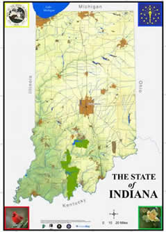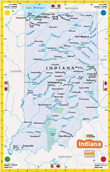

The Geography Educators’ Network of Indiana announces the newest classroom resource to enrich student Geographic literacy and to empower educators. In order to improve access to the GTM IN, at no cost, the borrower must assist with map and resource trunk pick-up and delivery. To schedule a school visit, contact GENI at the following e-mail: geni@iupui.edu.
The GTM IN measures 15 feet wide x 21 feet long; it rolls into 3 vertical sections of 5 foot widths for a carrying width of about 5 feet. The GTM IN, then, rolls into a diameter of approximately 13”. Next, the Map is bound by straps and fits into a large duffel bag measuring about 5 feet long. The Giant Traveling Map of Indiana was designed for ease of transport in most vehicles.
The GTM IN Resource Trunk measures 2’ high x 18” wide x 3’ long, with wheels and a handle, and is full of the ancillary materials needed to successfully implement the available lesson plans: plastic cones & chains, county cards, place-card holders, scale tools, images, and possible literature you may want to incorporate.
Borrowing the GTM IN works best if you can locate other schools, libraries, museums, or businesses in your area that may also want to utilize the Map also. In this fashion, we hope that the Map can travel the state being driven from location to location by the Borrowers. This saves on shipping expenses – enabling the Map to be loaned for free.
ImagesWant a GTM IN for your school/school corporation?
Evaluation
Curriculum
- Famous and Notable Hoosiers A listing
- Indiana Pizza Box Project To broaden the students’ awareness of the counties in the state of Indiana through research and creativity.
- Indiana Pizza Box Project student worksheet
- Leaders of the State: Indiana Governors on the Giant Map In order to better understand how Geography has influenced politics in Indiana, students will learn of Indiana’s past through the lives and achievements of Indiana’s governors.
- The Executive Branch of Indiana Government: Information Maintained by the Office of Code Revision Indiana Legislative Services Agency, Article 5
- Madonna of the Trail and the National RoadTo introduce students to Indiana’s early roads and transportation routes.
- Marking History on the MapIn order to explore the state through a historical and geographical perspective, students will identify and study various federally recognized sites and locations throughout the state.
- Native Americans On the MapStudents will identify Native American groups that lived in Indiana and understand their influence on Indiana.
- Native American Place Names in Indiana(From Indiana Place Names by Ronald Baker and Marvin Carmony)
- On the Banks of the WabashTo help students develop a better understanding about Indiana’s mighty river.
- Indiana Hydrology blackline map
- Indiana Counties & County Seats blackline map
- Scavenger HuntStudents will identify geographical aspects of Indiana using the Giant Traveling Map of Indiana.
- Simon Says…Students will explore Indiana by using the Giant Traveling Map of Indiana to participate in the game Simon Says.
- The Floating HouseTo introduce migration and transportation in the development of Indiana, students will read the story “The Floating House” while using the Giant Traveling Map of Indiana.
- The Invisible Railroad: Indiana and the Underground RailroadTo help student learn of the role of the Hoosier state in the Underground Railroad Movement through the use of maps and research.
- Urbanization and Indiana In order to better understand a GIS, students will study historic, modern, and future population and urbanization trends in the state of Indiana, then, will apply their skills and knowledge to global nations/nation states/countries. Recommended for high school students taking Geography & History of the World or AP Human Geography.
- Weird and Wacky IndianaStudents will use maps of all shapes and sizes and references to identify characteristics of places and to identify, describe and understand what makes a place unique socially, historically, and geographically.
- Welcome to Indiana!Students will become more familiar with their home state through an introduction to the Giant Traveling Map of Indiana: good review of basic map skills, too.
- What’s in a Name?Students will discover the origins of our county names and the person/persons behind the name.
- Where the Money IsStudents will make observations and draw conclusions about information given on a map.
- Suggested Literature List
Giant Storms
- Path of the Palm Sunday Tornado Outbreak, April 1965 (news/media)
- Tornadoes Palm Sunday Outbreak IN April 1965 Pathways Map
- Tornadoes Central IN Locations & Clusters April 1965 Map
- Tornadoes Central IN Pathways April 1965 Map
- Tornadoes Northern IN Locations & Clusters April 1965 Map
- Tornadoes Northern IN Pathways April 1965 Map
- Giant Storms
