What’s New
IN ArcGIS Online Story Map Competition RESULTS – Top 5
2019 Indiana State GIS Day
2019 GOLDEN HOUR SMARTPHONE PHOTOGRAPHY WORKSHOP AT SUMMIT LAKE STATE PARK (FALL SESSION)
Indiana and You: A Free Indiana Studies Workshop 2.0 (July 15-18)
Dr. Rick Bein’s Honored
2019 Indiana Geographic Information Council Annual Conference
2019 Indiana Geographic Bee Airdates for Indiana Public Broadcasting Stations
Events
-
Tue31Jan20237:00 - 8:30 PMZoom
Erin Farrell Rosenberg
Visiting Scholar, Urban Morgan Institute for Human Rights
University of Cincinnati College of LawOrder your 2023 Great Decisions Book!
Erin Farrell Rosenberg is a licensed attorney specializing in International criminal law (ICL), reparations, and genocide prevention. She spent a decade working in ICL, beginning at the International Criminal Tribunal where she assisted the Trial Chamber at the pre-trial stage on the Prosecutor vs. Ratko Mladic case. She then moved to the International Criminal Court (ICC), first in the Appeals Chamber where she worked on the ICC’s first judgment on reparations in the Lubanga case. She then continued her focus on reparations by leading the legal work at the ICC Trust Fund for Victims. In this role, she designed the Court’s first reparations beneficiary eligibility screening system, conducted harm assessments and victim consultations for purposes of reparations design and implementation planning, and oversaw the implementation of the first reparations to beneficiaries in the ICC’s history.
Upon returning to the US, she served as the Senior Advisor for the Center for the Prevention of Genocide at the United States Holocaust Memorial Museum, where she was the lead author for the report series, Practical Prevention: How the Genocide Convention’s Obligation to Prevent Applies to Burma and the Center’s legal work on the situations in Myanmar (Burma) and Xinjiang, China.
Currently, she works as a legal consultant, advising a number of NGOs and victim groups on legal and policy issues related to atrocity crimes and conflict situation. She is also, on a consultant’s basis, the Senior Legal and Policy Advisor for the Red Line Initiative, recently initiated by the Mukwege Foundation together with 2018 Nobel Peace Laureate Dr. Denis Mukwege, which seeks to create an international convention for the elimination of sexual violence as a method of warfare.
-
Tue14Feb20237:00 - 8:30 PMZoom
Moderator
Jason "Jake" Hawes is a PhD student in the School for Environment and Sustainability at the University of Michigan. He is a member of the Urban Sustainability Research Group with Dr. Joshua Newell, studying the role of urban agriculture in a changing climate.
Speakers
Zanagee Artis is a 23 year-old from Clinton, Connecticut, USA and a graduate of Brown University. He is a founder and the executive director of the global youth-led climate justice organization Zero Hour. Zanagee is also co-author of A Kids Book About Climate Change and co-host of 1 Point 5: A Kids Podcast About Climate Justice. Artis has been featured in a number of publications for his work on climate justice and climate policy, including The New York Times, Teen Vogue, and The Economist. In March of 2022, Zanagee traveled to Antarctica with the 2041 Foundation as an ambassador of the Global Choices Arctic Angels Network to witness polar climate impacts firsthand.
Magnolia Mead attends American University in Washington DC where she is President of the Sunrise Movement at the university, and active in several groups organized for climate justice as it impacts policy and legislation. Magnolia is a policy and legislative advocate and Director of US Organizing for Zero Hour.
Bella Wash is a Chemical Engineering major at the University of MIchigan where among many other things, Bella is a Michigan Research and Discovery Scholar; recipient of several academic distinctions and worked under the Climate Law Institute to support the group, California Law versus Big Oil.
-
Fri24Feb2023
How do we teach our students to communicate and plan and execute the change they desire in the world? NCSS defines Social Studies as the integrated study of the social sciences and humanities to promote civic competence. It is part of a well-rounded education that teaches critical thinking, speaking and listening skills, how to collaborate and to advocate.
Register today for the ICSS annual conference!
Join the Indiana Council for the Social Studies on Friday, February 24th, at the Indiana Landmarks Center in Indianapolis as we explore the ways we can prepare our students to be informed citizens of the world around them.
-
Sat25Feb202311:00 am - 1:30 pm
Indiana Council on World Affairs
Youth Education - Academic WorldQuest
FREE competition for high schoolsFebruary 25, 2023, 11 - 1:30, pre & post-events
Hybrid - in-person & virtual
https://www.fpa.org/You can help!
Let's engage high school students
in world affairs study & dialogue!Share - friends, family, teachers, students & community leaders.
Academic WorldQuest | ICWA (indianaworld.org)
ICWA - AWQ 2023 - Categories -
Tue28Feb20237:00 PM - 8:30 PMVirtual via Zoom
Speaker:
Dr. Pierre M. Atlas is a Senior Lecturer at the Paul H. O’Neill School of Public and Environmental Affairs at IUPUI, where he teaches graduate and undergraduate courses in their Public Affairs and Criminal Justice programs. He is also a faculty affiliate at the Center for the Study of the Middle East at Indiana University Bloomington and writes a monthly opinion column for the Indianapolis Business Journal.
Prior to joining O’Neill, Dr. Atlas was a Professor of Political Science at Marian University and for 17 years served as the Founding Director of The Richard G. Lugar Franciscan Center for Global Studies which included an interdisciplinary program in global studies and an annual speaker series.
He obtained his Ph.D. in Political Science from Rutgers University and holds master’s and bachelor’s degrees in Political Science from the University of Arizona and the University of Toronto, respectively. A comparative political scientist by training, Dr. Atlas devoted much of his academic career to studying and writing about Middle East politics and US foreign policy in the Middle East.
-
Tue18Apr20233:30 pmZoom
Speaker:
Sylvie Brouder, PhD
Director of the Purdue Center for Global Food Security
Wickersham Chair of Excellence in Agricultural ResearchThe PCGFS’s mission is to elevate the global food and nutrition security agenda and to engage with our varied partners in meeting the UN Sustainable Development Goals of eliminating hunger and nutrition insecurity by 2030 while conserving the natural resource base.
Dr. Brouder graduated from Harvard University (BA, Biology) and the University of California – Davis (PhD, Ecology); she studies agricultural productivity and agriculture’s impacts on the environment in a changing climate and oversees research activities at the Water Quality Field Station, an in-field laboratory and Purdue University Core Facility.
With expertise in soil health and climate smart agriculture, she works with various organizations and partners to develop, implement and assess public investments in science and capacity development. She has conducted in-depth reviews of the Consultative Group for International Agricultural Research Programs for the Food and Agriculture Organization and, with Purdue colleagues, designed graduate curricula for a World Bank-funded African Center of Excellence in Climate Smart Agriculture.
Dr. Brouder recently served as President for the American Society of Agronomy (ASA) where she advanced an array of initiatives to increase the rate of translation of science into guidance for policy makers and for evidenced-based practice in agriculture. She is currently serving a second term on the Standing Science Advisory Board for US Environmental Protection Agency to provide expertise in ecology, climate change and agriculture. She is a Fellow of ASA and the American Association for the Advancement of Science.
Will you be attending?
Click here to register! -
Fri21Apr2023
If interested in participating, please, submit your abstract to Dr. Yuri Kim (yurikim@iu.edu). The abstract must include:
the title, authors with affiliation, and description of your project (up to 250 words). -
Fri05May20235:00 pm
THE INDIANA COMPETITION
The 2023 theme for our statewide selection for the national competition isDiscovering Indiana & the World Through GIS
The maps should be about places and themes related to Indiana and tell a compelling story. What kind of story could be told with maps? There is a wide range of possibilities, from the local ecology of your hometown, stories about immigration to your community, natural treasures in your community/state, or peculiarities of Hoosier culture, environmental problems and other interesting topics.
THE NATIONAL COMPETITION
Middle and high school students and their teachers across the U.S. are invited to explore their world and create interesting online maps about their home state. The ArcGIS Online U.S. School Competition 2023 is open to middle school (grades 4-8) and high school (grades 9-12) students in the U.S. who analyze and present data via an ArcGIS Online presentation, web app, or story map.
THE PARTICIPANTS
The Geography Educators’ Network of Indiana (GENI) invites all middle and high school teachers and students to take part in this competition. All grades 4-12 public, private, or homeschooled students in Indiana (including 4th-grade elementary students) are eligible to enter the contest either through formal OR informal organizations. Each participating school can select up to 5 submissions.
THE MAP AND STORY
The competition is an initiative to stimulate the use of GIS technologies in schools and teach students to engage with their reality, analyze problems, and think critically about space and place. Participants use ArcGIS Online to tell an interesting (IN) story using data, maps, written words, photographs, videos, audio and more...a digital research paper that has a spatial component. You can find a large number of story map examples at https://www.esri.com/en-us/arcgis/products/arcgis-storymaps/stories (by professionals) and guides to get started at https://www.esri.com/en-us/arcgis/products/arcgis-storymaps/resources. ArcGIS Online is available to schools in the United States free of charge. Go to http://www.esri.com/industries/education/software-bundle#%20 to sign up for a free ArcGIS Online school organization (secure) account.
PRIZES
All students who submit maps and their teachers will receive a participation certificate from the Geography Educators’ Network of Indiana (GENI). The five maps judged the best in each category (middle school and high school) will be
awarded $100 Amazon.com gift certificates.
HOW TO GET STARTED?
Samples from previous competitions and additional information are available at the 2023 AGO link below or http://esriurl.com/agoschoolcompinfo (full details).
For further materials and assistance, please, get in touch with Jörn Seemann (mappingindiana@gmail.com), go the Mapping Indiana Facebook Group (https://www.facebook.com/groups/2467716709977131/) or visit the GENI website for updates (https://geni.iupui.edu).
The deadline for submitting student maps for the statewide competition is May 5, 2023 @ 5:00 p.m. Eastern Time. State Awardees will be announced on May 12, 2023.
-
Wed10May2023Fri12May2023Evansville, IN
IGIC Emerging Professional Group
2nd Research CompetitionPost-secondary students utilizing GIS in any application and for diverse purposes can enter, whether they
are in a Geography/GIS course or not. Entrants can be undergraduate freshmen through graduates, can
be using GIS for the first time or can be experienced GIS users. The first EPG Competition (December
2022) had students using GIS for the first-time while exploring tornadoes & rural sirens/notifications in
northern Indiana; waterways & invasive species; police response & use of force in Bloomington; crimes &
bird protections in the U.K.; wetlands changes in Allen County; peacefulness of neighborhoods in
Bloomington...and more. One of the graduate students focused on electric vehicle adoption in relationship
to extreme temperatures. The students represent a wide variety of areas of interest/fields of study/visions
of majors & minors.
The Emerging Professional Group invites YOU and/or YOUR students to submit an abstract and/or to
become involved with the Group. Benefits to EPG involvement include: meeting other students employing
GIS/geospatial tools from a wide variety of backgrounds, experiences and fields of study; access to IGIC's
professional development opportunities, which include webinars, in-person
workshops/forums/conferences; networking with (Indiana's) GIS/geospatial professionals; connections to
the most up-to-date geospatial tools, training, knowledge, research and individuals; inroads to GIS-related
internships and employment across diverse fields; opportunities to contribute to policies and procedures
navigating the direction in which Indiana GIS/geospatial technologies/data management heads...the
EPG's participants futures!
The EPG 2 nd Research Competition will be hosted at the 2023 IGIC Annual Conference (May 10 - 12, Evansville, IN).
Many talented young Geospatial/GIS scholars have been enriching our Indiana GIS community.
Meet our fellows and celebrate emerging GIS professionals’ contemporary work!
If you or your students have questions, please contact Yuri Kim (yurikim@iu.edu).
---------------------------------------------------------------------------------------------------------------------------------------------------------
If interested in participating, please, submit your abstract to Dr. Yuri Kim (yurikim@iu.edu). The abstract must include:
the title, authors with affiliation, and description of your project (up to 250 words).
Important Timeline
- April 21, 2023: Deadline to submit your abstract
- April 28, 2023: Announcing entrants invited to share their projects.
All invited speakers will receive free one-day (Thursday) IGIC Annual Conference registration (meals included).
Prizes
- 1st place = $150
- 2nd place = $100
- 3rd place = $50
All winners will receive an achievement letter from the current IGIC president. -
Wed10May2023Fri12May2023Old National Events Plaza, Evansville
Earlybird Rates: Member, $295; Non-Member, $440; Student, $100 (rates increase after April 21)
REGISTRATION AND MORE INFORMATION
VIEW SCHEDULE
NOMINATE AN INDVIDUAL OR ORGANIZATION FOR AN AWARDThe 2023 Annual Indiana GIS Conference is less than three months away! If you haven't yet registered as an attendee, exhibitor or sponsor, now's the time to sign up!
The IGIC's website has been updated with the latest version of the conference schedule. Be sure to check out the vast and dynamic sessions being offered!
Also, don't forget about the Esri Hands-On Learning Lab that will be available during the conference. This is an excellent opportunity to learn about ArcGIS software at no additional cost to you.
Each year, our goal remains the same -- to bring the GIS community together and capitalize on the growth of the technology in our state by delivering a comprehensive and relevant conference program. We hope you can join us!
-
Wed25Oct20234:30pm - 5:30pm
Grade Level: 6-8 and 9-12
From the Population Connection: Help your students unpack the complexities of climate change. During this interactive virtual session, facilitators will share activities that encourage analysis of various types of climate data, explore the disproportionate impacts of climate change on the world’s most vulnerable, and highlight how humans have altered global ecosystems.
FREE educator training: virtual workshop is perfect for earth/environmental science teachers as well as social studies/geography teachers.
-
Fri27Oct2023Sun29Oct2023Columbia SC Metropolitan Convention Center 1101 Lincoln St, Columbia, South Carolina, United States
National Council for Geographic Education (NCGE) invites you to attend our 108th Annual Conference This in-person gathering of K-12 geography teachers, college and university faculty members, curriculum designers and […]
-
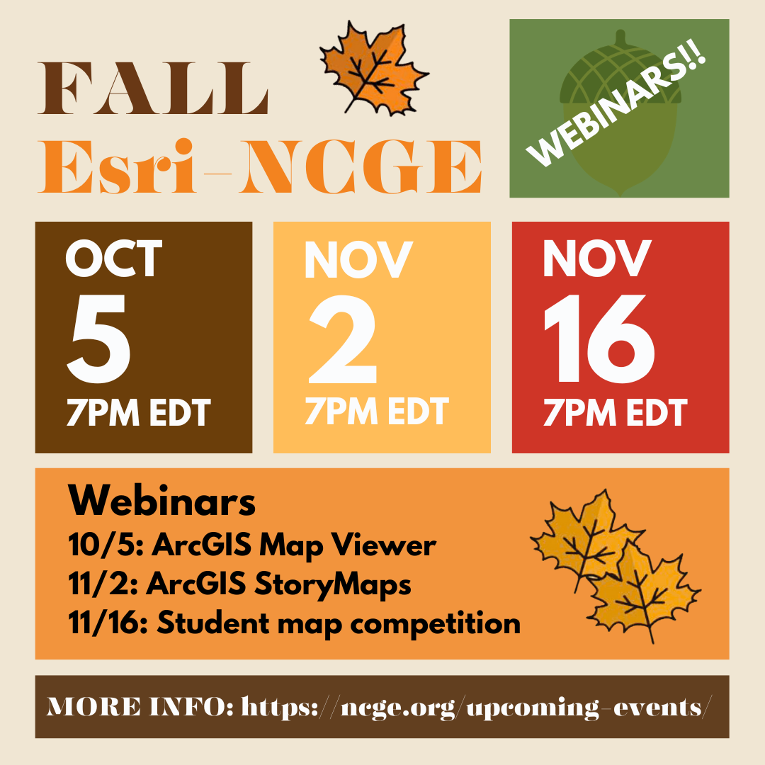
Thu02Nov2023
-
Fri10Nov2023
-
Wed15Nov202312:00 pmIndiana Government Center South Building Atrium, 302 W Washington St, Indianapolis, IN 46204

GIS Day 2023
INSPIRE THE WORLD THROUGH GIS

Save the Date and Register today! The State of Indiana’s GIS Day is Wednesday, November 15, 2023, 8:30am to 3:30pm.
Participate in our celebration of Geographic Information Systems (GIS) in the State of Indiana, and beyond. GIS is a set of tools, data, and people that gather, analyze, and visualize spatial data (maps!) to help us make better decisions. The Indiana Geographic Information Office’s GIS Day will focus on helping others learn more about geography and the real-world applications of GIS that help make a difference. GIS day is our opportunity to celebrate the achievements of the GIS community in Indiana, and more broadly. This is our chance to share accomplishments and inspire others to use GIS!
The event is free and will take place in the Indiana Government Center South Building Atrium (located at 302 W Washington St, Indianapolis, IN 46204). Lunch will be included, courtesy of Sanborn, and sessions will focus on GIS Implementation, Technical Practice in GIS, and GIS Innovations in Indiana and elsewhere.
Registration may be limited to the first 400 participants.
Register to Attend:
Submit an Abstract:
Deadline: August 23, 2023
-
Thu16Nov2023
-
Thu30Nov202312:00pm - 1:00pm
Presenter: Alex Elvis Badillo, Assistant Professor in the Department of Earth and Environmental Systems at Indiana State University
Alex is the founder and director of the Geospatial and Virtual Archaeology Laboratory and Studio (GVALS). His archaeological research takes place in Mexico, Peru, Italy, and the USA. He specializes in Mesoamerican archaeology, settlement pattern survey, human-environment interactions, and the applications of geospatial and 3D technologies in archaeology.


 RSS Feed